
Groundwater Flow and Water-Quality Modelling
Saudi Environmental Studies provides groundwater modelling in Saudi Arabia, covering groundwater flow and water-quality modelling for project teams that need to examine flow direction, drawdown, seepage, recharge and potential contaminant movement beneath a site. We scope, coordinate and manage the work; qualified hydrogeologists and modellers carry out the modelling, and appropriately licensed environmental consultants are responsible for formal assessments and submissions.
You receive a written proposal setting out the conceptual model, data needs, method, deliverables and price. Request a quotation
Drilling, sampling, laboratory analysis and software are provided by the appointed specialists and partners, and the current regulatory basis is confirmed for each project.
Start with a conceptual site model
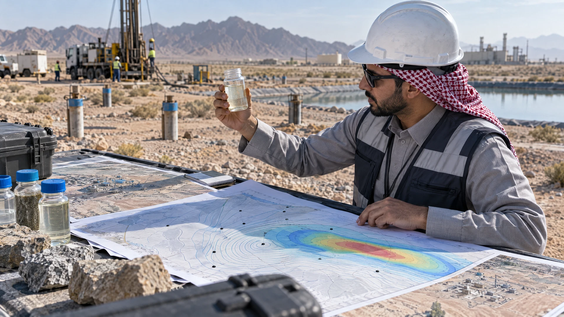
Before numerical modelling, the hydrogeologist describes the geology, aquifers and aquitards, groundwater levels, recharge and discharge, surface-water connections, abstraction, site infrastructure and potential sources. This conceptual model defines what the numerical model must represent and where uncertainty is greatest.
Existing borehole logs, pumping tests, monitoring wells, geological maps, rainfall, abstraction records and laboratory results are reviewed for quality and coordinate consistency. A model cannot repair weak data silently. Gaps may require a phased field programme covering drilling, sampling, survey and laboratory work.
For contaminated sites, contaminated land assessment and remediation planning connects groundwater evidence with soil, source history, exposure pathways and remediation decisions. Environmental due diligence and Phase I/II site assessment can establish the initial liability question.
Define the model decision
Questions may include construction dewatering, excavation inflow, water-supply effects, seepage, landfill or lagoon leakage, contaminant migration, remediation design or long-term closure. Each requires a different domain, time horizon and level of complexity. The hydrogeologist states whether a screening calculation, analytical model or numerical model is appropriate.
USGS maintains MODFLOW and related programs for simulating groundwater flow and associated processes. MODFLOW is a recognised technical platform, but it is not required for every Saudi project. The appointed modeller documents the software, version, packages and applicability.
Groundwater modelling in Saudi Arabia: build and test the flow model
Inputs can include model layers, hydraulic conductivity, storage, recharge, boundaries, wells and surface-water features. Calibration compares simulated heads or flows with suitable observations. Parameter choices should remain consistent with field evidence and geology rather than merely producing a visual match.
Sensitivity and uncertainty analysis identify parameters that control predictions. Where data supports it, validation or predictive checks may be performed against another period or dataset. The report shows residuals, water balance and limitations according to the method used.
Add water-quality or contaminant transport carefully
Transport modelling may require source concentration or mass, porosity, dispersion, sorption, decay, density or geochemical processes. A plume map is conditional on those inputs. The specialist should not add complex processes without evidence, or omit important processes merely to simplify the model.
Laboratory results can inform source and groundwater concentrations. The laboratory’s method, detection limits and current relevant accreditation scope are checked; accreditation belongs to the laboratory, not to Saudi Environmental Studies.
Use scenarios to support decisions
Scenarios may examine pumping rates, excavation stages, barriers, source removal, monitored natural attenuation assumptions or future land use. The hydrogeologist distinguishes predictions from design. Dewatering systems, wells and remediation works remain the responsibility of the appointed engineers and contractors.
The deliverable generally includes:
- the conceptual site model and data inventory;
- the domain, grid, boundaries and parameters;
- calibration and water balance;
- transport assumptions, scenarios and uncertainty;
- results and files where agreed.
GIS and environmental-constraints mapping helps align boreholes, sources, receptors and property boundaries.
Saudi Environmental Studies is available for groundwater modelling projects across Saudi Arabia, including industrial and development projects in Riyadh, Jeddah, Dammam and Jubail.
Maintain the model as evidence changes
A groundwater model represents a defined conceptual understanding at a particular time. New boreholes, longer monitoring records, changed abstraction or construction progress may justify updating it. The handover therefore identifies the master files, input sources, calibration period and triggers for review. Future users should not extend predictions beyond the tested scenario or time horizon without the hydrogeologist’s assessment.
Frequently asked questions
Who provides groundwater modelling in Saudi Arabia?
Saudi Environmental Studies provides groundwater flow and water-quality modelling in Saudi Arabia. We scope and coordinate the work, and hydrogeologists, modellers and licensed consultants deliver it.
What data is needed for a groundwater model?
Borehole logs, groundwater levels, hydraulic tests, geology, abstraction, recharge, boundaries and project designs are common inputs. Transport work also needs laboratory chemistry and source information.
How do I choose between MODFLOW and another method?
MODFLOW is a recognised USGS platform but is not always required. The modeller selects the method and version appropriate to the question and authority requirements.
Can modelling replace monitoring wells?
Usually not. Field observations establish conditions and support calibration. The hydrogeologist defines the monitoring needed for a defensible conceptual and numerical model.
Can the model design a dewatering system?
It can inform drawdown and inflow predictions. Final dewatering design, construction and safety remain with the responsible engineers and contractors.
What affects the cost and duration of groundwater modelling?
Cost and programme depend on the modelling question, the quality of existing data, any field programme needed, transport complexity and the number of scenarios. Your proposal sets these out.
Does the model prove there is no liability?
No. It is one line of evidence with assumptions and uncertainty. Legal, transaction and regulatory conclusions require the appropriate professional review.
Saudi Environmental Studies serves projects across Saudi Arabia, including Dammam, Al Khobar, Jubail, Riyadh, Jeddah, NEOM and Qiddiya.
Next step
For groundwater modelling in Saudi Arabia, send us your site setting and modelling question. Request a quotation
Project scope review
Define the scope before specialist work begins.
Share the project location, activity, stage, required milestone and available technical information.