
Baseline Environmental Studies
Saudi Environmental Studies provides baseline environmental studies in Saudi Arabia, coordinating the scope, field teams, laboratories, datasets and reporting interfaces for owners. A baseline study describes relevant environmental conditions before a project action or at a defined point in an operating facility’s life; its purpose is not to collect every possible parameter, but to provide representative, traceable evidence for an environmental impact assessment, permit, design decision, compliance review or future comparison.
You receive a written proposal setting out the baseline scope, deliverables, timeline and price. Request a quotation
We scope, coordinate and manage the work. Where baseline work supports a regulated study or submission, the programme and interpretation are controlled by an appropriately licensed environmental consultant, with the identities, licences, laboratory scopes and responsibilities of all contributors confirmed before mobilisation.
Design the baseline around the assessment question
The environmental scoping and terms of reference identify the project actions, pathways and receptors that the baseline must characterise. They also define spatial coverage, seasonal needs, duration, parameters, methods, detection limits, quality controls and data format. A construction dust question, coastal outfall assessment and groundwater risk study require different evidence.
NCEC states that its environmental-media monitoring remit includes air, water, soil, coastal environment, noise and light pollution (NCEC environmental-media monitoring). This confirms the relevance of multiple media in Saudi environmental oversight. It does not prescribe the locations, frequency or methods for an individual project; those are determined through current authority requirements and the licensed study team.
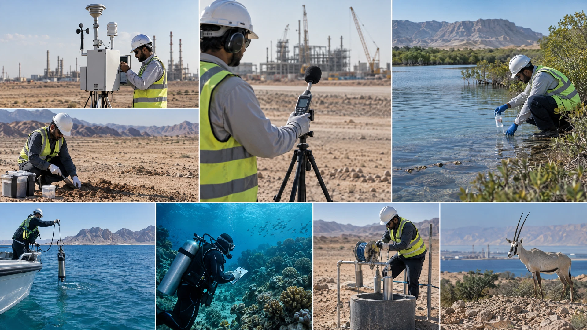
Baseline environmental studies by medium
Each medium has its own method:
- Air: existing official information, continuous or periodic measurements, meteorology and source context.
- Noise: measurement positions, periods, operating conditions and relevant receptors.
- Water: surface water, groundwater, marine water, wastewater or other matrices, with field observations matched to laboratory parameters.
- Soil and sediment: a sampling rationale tied to land use, potential sources, geology and future decisions.
- Ecology: terrestrial or marine specialists, survey timing appropriate to target features, access and permits where applicable.
- Coastal: currents, tides, bathymetry, sediment and habitat information for a later model or impact assessment.
Common controls improve integration: one coordinate system, agreed location identifiers, synchronised project and operating records, standard metadata and a shared document register. A field point is traceable from plan to field sheet, sample label, chain of custody, laboratory report and baseline database.
Protect data quality from planning through reporting
The quality plan addresses equipment suitability, calibration or verification, sample containers, preservation, holding times, blanks, duplicates, chain of custody, laboratory method, reporting limits, data validation and deviations. Requirements vary by medium and method, so controls follow the chosen standard rather than a generic set.
NCEC’s site says environmental-service providers are licensed and their performance is evaluated and monitored (NCEC provider licensing). It also identifies environmental laboratories within its areas of work and publishes qualified entities through an official lookup. The owner and licensed consultant verify the laboratory’s current status, accreditation where required, and method-specific scope rather than relying on a general capability statement (NCEC qualified entities).
Field deviations are documented, not concealed. Access restrictions, weather, equipment downtime, dry wells, changed operations, sample damage or missed locations may affect representativeness. The responsible specialist decides whether replacement work, qualification or a changed interpretation is needed.
Turn measurements into a defensible baseline
The report states the project and assessment purpose, methods, locations, dates, environmental and operating conditions, quality-control results, data completeness and limitations. Maps and tables use consistent units and identifiers. Results are compared with applicable criteria only after the licensed consultant verifies the correct criterion, averaging basis and context.
Baseline data is interpreted in context rather than reduced to pass/fail statements. Spatial patterns, seasonal variation, existing sources and natural background may be relevant. Outliers are investigated, and no result is deleted without a documented technical reason.
For an environmental impact assessment or ESIA, the baseline becomes the reference against which impact pathways and receptor sensitivity are assessed. For an environmental management plan, it helps define monitoring locations, triggers and future comparison. Equipment supply is a separate monitoring-system scope; this service covers formal baseline-study design and interpretation.
Deliverables can include the approved programme, mobilisation plan, health-and-safety interfaces, field and laboratory responsibility matrix, GIS files, validated dataset, photo and field records, laboratory reports and integrated baseline report. Authority acceptance depends on the authority’s own review. To request a scope, provide the site, project stage, assessment purpose, available data, schedule and likely authority through our contact page.
Frequently asked questions
Who provides baseline environmental studies in Saudi Arabia?
Saudi Environmental Studies provides the coordination of scope, field teams, laboratories, datasets and reporting. Sampling and laboratory analysis are delivered by field teams and laboratories whose method scope is confirmed for the project.
Which environmental media can a baseline cover?
Depending on the project, it may cover air, weather, noise, surface water, groundwater, marine water, soil, sediment, ecology, light or relevant social and land-use conditions.
How long should baseline monitoring run?
Duration follows the question, variability, season, authority requirements and method. A short survey may answer one issue but not represent seasonal conditions.
Can existing data replace new fieldwork?
Possibly, if its location, age, season, method, quality and project context are suitable. The licensed consultant documents that determination and any gaps.
Where can I get a baseline environmental study for my project?
Send the site, project stage, assessment purpose and available data. Saudi Environmental Studies then defines the programme and coordinates the field and laboratory contributors.
What affects the cost of a baseline environmental study?
Cost depends on the media covered, the number of locations, the survey duration and seasons, the laboratory parameters and the reporting required. It is set out in your proposal.
How long does a baseline study take, and does it obtain permit approval?
Duration follows the media, seasons and laboratory turnaround and is confirmed in your proposal. A baseline report provides evidence within a wider application; the relevant authority decides whether it is sufficient.
Saudi Environmental Studies serves projects across Saudi Arabia, including Dammam, Al Khobar, Jubail, Riyadh, Jeddah, NEOM and Qiddiya.
To arrange baseline environmental studies in Saudi Arabia, share your site and assessment purpose and request a quotation.
Project scope review
Define the scope before specialist work begins.
Share the project location, activity, stage, required milestone and available technical information.